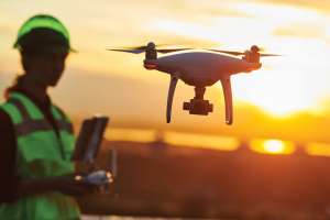
Drones aren’t just for taking pretty pictures anymore. Sophisticated analytics, tools to improve safety and compliance, simplification of survey work — drones are on their way to becoming contractors’ new best friends.
Today’s construction industry is on the leading edge of advanced drone technology, with next-generation technology that increases efficiency.
“Years ago, the expectations were really high, but the capabilities weren’t quite there,” says John Frost, vice president of business development for Propeller Aero. “People expected drones to revolutionize the industry, but the capabilities were more like you’re going to get a pretty map, a nice-looking aerial view of your site.”
Propeller Aero is a drone data analytics platform that specializes in work site applications.
“Now, there is the ability to interact with these sites, importing design surfaces — what that site is supposed to look like in the end when it’s built — and comparing that to the drone surface, with sub-inch accuracy,” he says. “The capabilities of the analytics and the tools that are accessible now are matching the expectations. It’s definitely caught up.”
WHAT DRONES CAN DO FOR YOU
When drones first hit the commercial market and became accessible to small and midlevel operations, people weren’t really sure what to do with them. As a result, like Frost says, many ended up with nothing more than nice photos and video of the job site.
Aerial views aren’t without merit on their own, as some companies have demonstrated through creative use in marketing. RiverView Construction uses images of completed job sites for promotions and has even presented framed copies for customers as a gift, earning goodwill and building reputation. Murphy Pipelines has done promotional videos with its drone footage.
But the potential of drones has largely gone unfulfilled.
“We’re pretty much in the infancy of this thing, just getting off the ground,” says Dave Marzio, Spearhead Locating Services owner. The company partners with VTA Drones to map out their pre-construction surveys and markings.
Often, Marzio’s crew will mark up a site well in advance of actual construction, with the result that those markings can fade or be destroyed in site prep. When this happens, contractors have to call surveyors back out to the job site — a costly repetition.
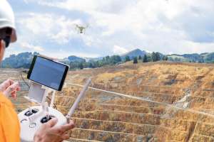
Surveying is one of the most common uses of advanced drone technology.
“With drones and the analytical tools we supply, they’re just spending less time in collecting the actual data and processing it,” says Justin Van Fleet, owner of VTA Drones. “They’re able to generate these reports quickly and get on to the next thing.”
When hiring someone to do mapping, traditionally it takes a lot of man-hours. They have to collect GPS point, references to existing structures and then put that into a CAD program.
“With the drone, it significantly reduces labor overhead and allows you to generate a map very quickly that’s very accurate,” Van Fleet says. “There’s a lot of interest out there, mainly because of the cost savings.”
As for locating crews like Spearhead Locating Services, though they miss out on a billing opportunity for that follow-up work, they make up for it with repeat business. “It gives the customer incentive to use me again because it’s an added benefit to them,” Marzio says. “They’re getting more products for their money, added value.”
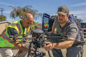
MORE THAN JUST A FLYING CAMERA
In essence, these developing technologies combine drones and advanced sensors to take measurements from the sky, which are then imported to software platforms that can analyze data for specific metrics and goals.
“There are a number of different people across a work site who it benefits,” Frost says. “Typically, it is the site foreman or the construction supervisor who gets the most bang for buck, right upfront, and then that trickles around to others.”
As the cost of drones becomes more affordable and the benefits more recognized, some contractors are opting for more frequent flyovers.
“Because of the dramatically lower cost, it allows the end user to have me come out more than once during a construction project, to make a continuous log of the work that’s being done,” Van Fleet says. “Maybe we come out first to do locating work, then they go out and do some grading and have us come back out to make record of that. It’s a great way to keep a very thorough record of the site and has a much lower cost.”
Drone operators already have the capabilities to perform a variety of functions, and right now it’s just a matter of making those options known to contractors.
“Quickly calculating an overall site volume, doing weekly or monthly site volumes, and comparing the latest drone survey to the previous — if you’re working on haul roads, for example, and you have to survey it, we have a way to do that, including road grades, cross slopes, road widths and so on,” Frost says. “They can compare that to design or any kind of topographic survey.
“We’re still in that educational phase, getting people more comfortable with the level of detail that can be provided here, getting them comfortable with overcoming any kind of technology barrier,” he says. “We do make everything super simple to use, because we have both ends of the spectrum in mind: those that have no technical background and those who want to get really technical and go down the road of customization.”
Though it’s the early days for the technologies, and contractors are just beginning to scratch the surface on potential uses and benefits, all these drone users say demand is increasing.
“I would definitely say that drones are becoming much more common, both for keeping record of the construction progress, with still images or video, and much more so on the mapping side,” Van Fleet says. “I think that is the main application for construction, where the end user can see some tangible benefits of the drone technology.”
VTA Drones also has a remote viewing service, where Van Fleet can inspect structures like bridges or towers — anything that might be difficult to access manually — and transmit those images back to workers on the ground or even in an office, so they can inspect remotely in real time.
Another service they offer is setting up servers and digital infrastructure to manage the extensive data collected by the drones.
“I would say the layering of that information is what’s really important,” Frost says. “We’ve built our platform with the ability to take in multiple types of data — giving that complete picture of a work site. That’s where we see the industry going.”
WHAT’S NEXT
So far, response to these technologies has been favorable, with most contractors jumping on board quickly once they are exposed. But even while most of the industry is playing catch-up, drone analytics companies like VTA Drones and Propeller Aero are already looking ahead.
“Where we see the most movement forward is being able to tie in, for example, the machine surface data,” Frost says. “The use of intelligent construction equipment is just taking off itself, and we feel that we’re very complementary to that. Drones are just a method of collecting that kind of information, and we definitely see other ways of collecting it.”
Commercial drones and accompanying tech have only been on the market for a matter of years, but costs are already decreasing significantly and will most likely continue to do so, alongside an increasing catalog of software options and value.
“We’re just beyond that early adopters curve. Now the wider market is certainly starting to open up, but there’s still always an educational component: What can you do, what kind of investment — time, effort and so on,” Frost says.
As for contractors, with the increasing challenge of finding qualified help across the industry, technologies like this may help close the gap for those struggling to keep up with demand.
“It’s just a very new idea right now, and people are just starting to open their eyes to what’s out there,” Marzio says.
Continue reading for free