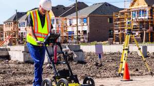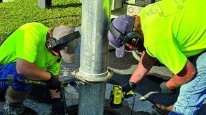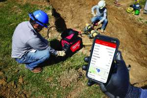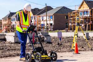
Before any excavation begins, precise utility locating is non-negotiable for job site safety and damage prevention. Today’s electronic locators go far beyond basic line tracing, integrating survey-grade GNSS mapping, customizable RFID marker detection and multi-frequency sonde tracking.
These rugged, high-contrast digital instruments allow contractors to pinpoint buried infrastructure, including non-metallic pipes or abandoned lines, with centimeter-level accuracy. By combining real-time depth measurements, mobile data capture and ergonomic designs, these advanced tools will streamline your workflow. In increasingly crowded underground environments, empowering yourself with proactive infrastructure management tools like these will help reduce or eliminate costly accidental strikes.
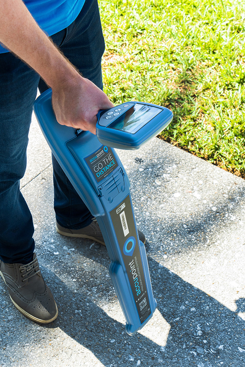
CUES Accupoint
Locating and tracing CCTV inspection systems can present major difficulties. This can be made even worse in cases where a pipe has rubber seals, insulators or gaps between sections. These problems, if not overcome, can result in costly repairs, delays and in some instances, personal injury. The CUES Accupoint precision locator and transmitter was designed to address these issues. The Accupoint series features depth measurement, guidance mode and compass orientation to make sonde and pipeline locates easier and safer. Ease of use is at the heart of the products, coupled with the accuracy, repeatability and reliability. 800-327-7791; www.cuesinc.com
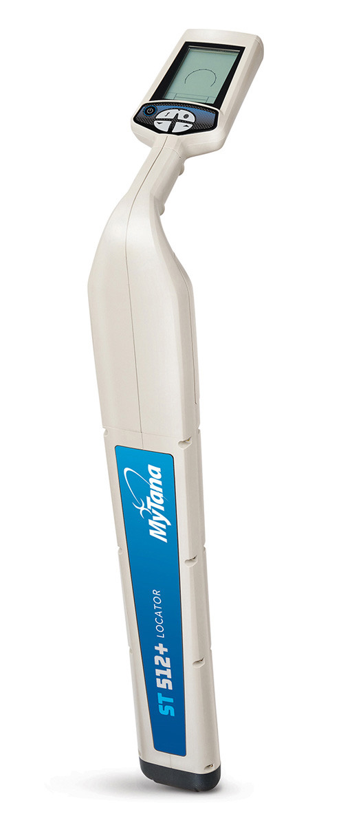
MyTana MT 512+ Locator
Accurate and easy to use, the MT 512+ Locator from MyTana is designed for sewer and drain contractors to pinpoint the location of 512 Hz signal transmission in all pipes, with the capability to detect many other frequencies. A large, high-contrast LCD display clearly shows signal response in bright sunshine or shadows, and displays real time data including continuous depth, signal strength and directional arrows which provide guidance to the target location. Audio response supplements the visual data. It is powered by a long-lasting, rechargeable Lithium-ion battery. Alone, it not only detects 512 Hz signal from all MyTana cameras as well as other sondes, but also 640 Hz, 815 Hz, 8K Hz and 33k Hz signals. Partner with a line transmitter to expand the frequency range and pinpoint the location of buried utilities. 877-833-2343; www.mytana.com
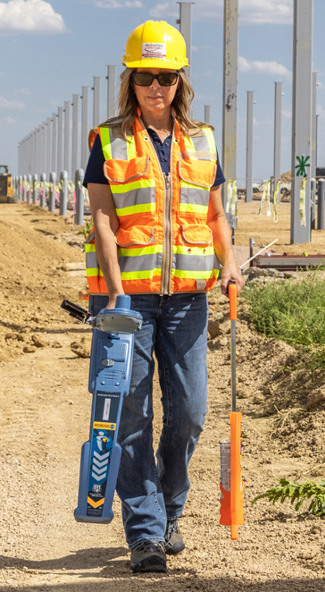
Radiodetection RD8200SG Survey-Grade Precision Locator
Locate and map buried utilities in a single operation with Radiodetection’s RD8200SG Survey-Grade Precision Locator. With an integrated GNSS antenna, users can view and build high-accuracy maps on a mobile phone while locating. It is designed to support accurate utility locating, with features such as interference rejection, Current Direction to help differentiate targets among parallel utilities and StrikeAlert to warn of shallow cables, thereby reducing the risk of accidents or damage to buried infrastructure. An ergonomic, lightweight design helps ensure comfort during extended use, while automatic usage logging and swing warnings help promote proper handling and enhance safety. When used with Locate Performance Management, the comprehensive digital solution helps utility owners track and manage locate operations, with tools that support locate quality assurance and validated mapping, as part of a proactive damage prevention program. 877-247-3797; www.radiodetection.com
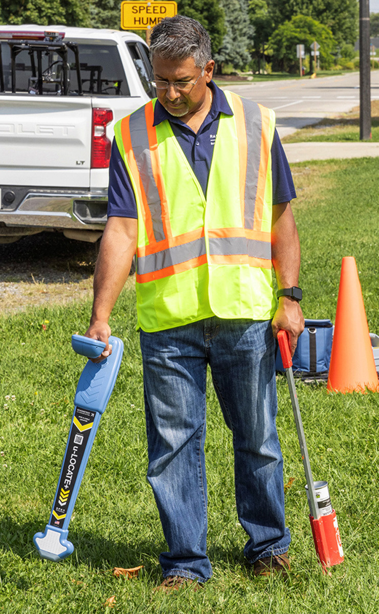
Schonstedt u-LOCATE+ Pipe & Cable Locator
Schonstedt’s u-LOCATE+ Pipe & Cable Locator is an easy-to-use, reliable and economical utility locating solution for contractors including plumbers, electricians, landscapers, site managers and facilities maintenance technicians who occasionally need to detect and trace buried utilities on the job site. It features a high-contrast display and a shock-resistant housing designed for use in demanding job site conditions. Dual locating frequencies of 33 and 82 kHz support active line tracing while passive power mode can be used to detect energized utilities. A 1-watt transmitter, depth estimation and left/right guidance arrows assist operators in identifying utility position and alignment. It can be used as an avoidance tool to help crews scan an area for buried utilities prior to excavation. The locator also includes 512 Hz sonde locating capabilities for tracing compatible sondes in nonmetallic lines, and supports accessories such as signal clamps and other locating attachments to extend functionality across a range of locating applications. 888-367-7014; www.schonstedt.com
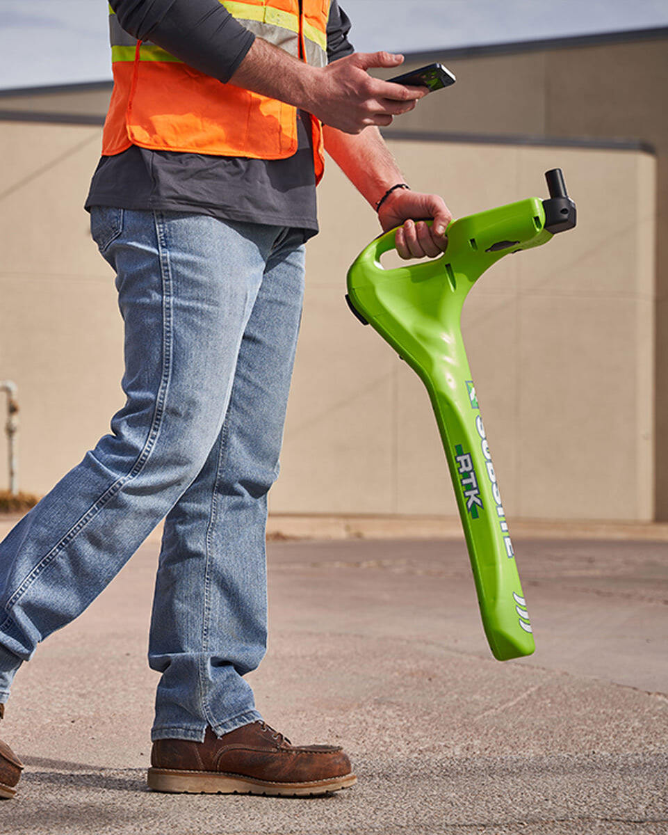
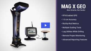
Subsite Electronics UtiliGuard 2 RTK
The UtiliGuard 2 RTK receiver from Subsite Electronics was designed as a simple, easy-to-operate utility locating option, making it the ultimate tool for operators locating, mapping and capturing underground utilities. It utilizes survey-grade technology and features dual-band antennas to provide operators with accurate and reliable positioning data with centimeter-grade accuracy. Its high-level of accuracy and precision make it an ideal solution for locating abandoned and untracked utilities that are often difficult to pinpoint. By quickly verifying the utilities installed, operators can efficiently tailor their bids to match a job site needs, as well as gain insight into the underground infrastructure to avoid cross bores during future projects. It provides crews with integrated data capture, GPS positioning and an intuitive user interface to help operators improve work quality and maximize location awareness. By downloading the MyUtiliGuard application, operators can simplify and streamline how they capture, map and share data. 800-846-2713; www.subsite.com
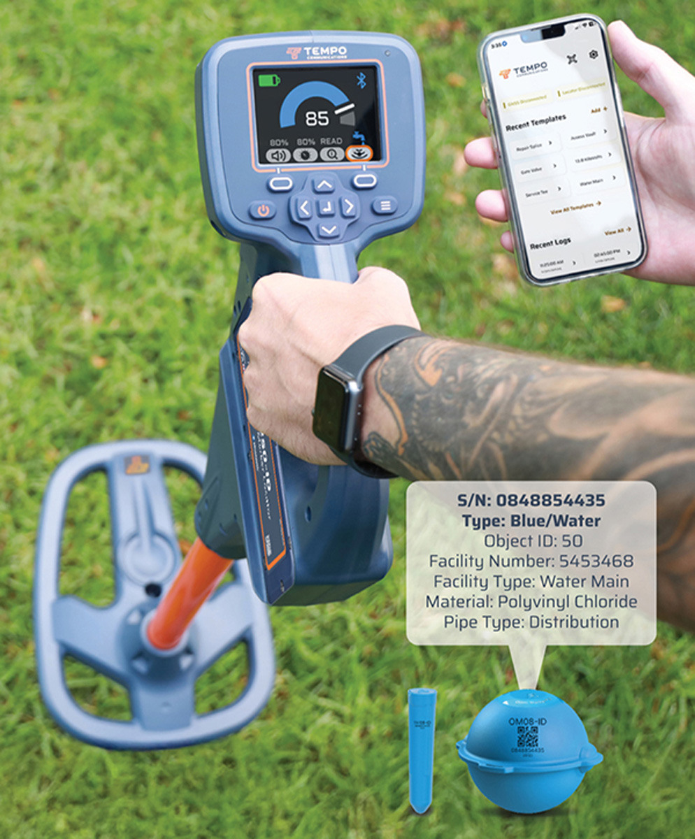
Tempo Communications EML250-ID Locator
The EML250-ID Locator from Tempo Communications delivers a reliable way to pinpoint buried utilities and points of interest with accuracy and ease. It is a comprehensive tool for locating and reading buried serialized RFID markers with the capability to write custom, asset-specific data to the markers pre-burial. The system includes two marker options: OmniMarker-ID (detectable to 5 feet depth) and Spike Marker-ID (detectable to 3.3 feet depth). Both markers are engineered for long-term durability and available in nine industry-standard frequencies for marking points of interest. It provides real-time capture of marker location coordinates, embedded information and a unique serial number. The locator supports external GNSS device connectivity, enabling enhanced accuracy in marker mapping. This RFID solution enables utility professionals to locate, identify and digitally record marked underground assets in a single workflow, supporting data-driven infrastructure management and precise field operations. 800-642-2155; www.tempocom.com
Continue reading for free